Latest flights

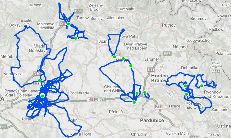
Map of the latest flights
Registration
Don't have an account yet? Create one for free and keep track of your powered paraglide flights.
Newest flights with video
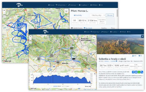
PPG Log
Flight Log for Powered Paragliding
Record your flights, view routes on the map, add photos, track accumulated kilometers, consumption, and other statistics...
 Application features:
- Management of powered paragliding flights
- Import from GPX and IGC files, bulk import
- Support for private flights and altitude profile hiding
- Bulk display of flights on the map ("Where have I flown so far")
- Detailed flight descriptions and log creation
- Photo gallery and videos for flights, display photos on the map
- Display of altitude and speed profiles
- Overall statistics (flight hours, kilometers etc.)
- Tracking average consumption
- Management of equipment (parachutes and paramotors) and flight hour tracking
- Pilot statistics – year-to-year comparison
- Map of all flights with the ability to search for flights and launch sites in a given area
- Video library – overview of all flights with video
- 3D view of flights and a panoramic view of the launch location
- Related flights, with whom you met in the air